Marine Notice #3 of 2017 – Helicopter SAR Hi-line technique


Skerries Coast Guard

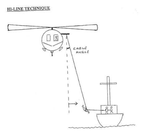
The Department of Transport, Tourism & Sport have recently issued Marine Notice #3 Helicopter SAR Hi-Line technique. The Marine Notice contains the latest guidelines for the safe operation of a hi-line. The hi-line is a technique that may be used by the helicopter crew for the safe transfer of persons or equipment between the helicopter and a vessel in difficulty.

All seafarers are recommended to read the Marine Notice #3 of 2017 and familarise themselves with the safe operation of the hi-line.

A copy of the Marine Notice #3 2017 is available from the dttas.ie website

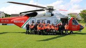
Coast Guard Hi-line

Marine Notice #28 of 2015 – survey operations off Rush coast, Co Dublin

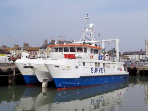
MV Bibby Athena

The Department of Transport, Tourism & Sport have recently issued Marine Notice #28 of 2015 advising of forthcoming survey operations off the east coast of Ireland. Commencing on 22nd June 2015 for a period not exceeding 60 days, two survey vessels (MV Bibby Athena & MV Proteus) will survey the route of the East West Interconnector between Rush, Co Dublin and Prestatyn, North Wales.

Survey operations will involve towing survey equipment on and below the water surface, up to 300m behind the vessels. All vessels, particularly those engaged in fishing are requested to give the survey vessels a wide berth and keep a sharp lookout in the relevant areas at all times.

The full text of the Marine Notice, along with survey route details is available from the Department’s website.

Marine Notice #3 of 2015 – deployment of data buoys, North Co Dublin

buoy_news_jpg__300x200_q85_crop_subsampling-2

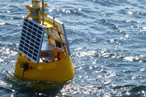
The Department of Transport, Tourism & Sport has been advised that Techworks Marine Ltd will deploy four moored Marine Data Buoys to gather scientific data on marine mammals. These buoys will be deployed in the Irish Sea at Loughshinny and Portmarnock between 9th and 16th February. One buoy will be deployed off the Loughshinny coast and will remain in place for up to six months.

Each data buoy is 1.2m wide, yellow in colour and has a navigation light as follows; yellow in colour, 5 flashes every 20 seconds. The light has a 5 Nautical Mile range. All vessels are requested to give the data buoys a wide berth.

These buoys are being deployed as part of the Greater Dublin Drainage project being conducted by Irish Water. Further details on this project are available from their website

The full text of the marine notice along with the exact locations of the buoys is available from the Department’s website.

.

Live surface to air firing at Gormanston Range – November 2014

Live firing Gormonston

The Defence Forces have advised that they will conduct live Surface to Air firing practices at Gormanston Ranges on the 4th and 5th November between the hours of 10:00 – 14:30.

The danger area comprises the lands of Gormanston Aerodrome and the Air and Sea areas contained within a radius of 3 nautical miles centred on Gormanston Aerodrome, with an additional area contained within a segment centred on Gormanston Aerodrome and bearing of 015º degrees true, through Mosney Railway Station and 106º degrees true, through Gormanston Railway Station seawards for a distance of 10 nautical miles. For the periods whilst the Range is active the sea zone within the danger area is excluded to all vessels.

A Naval Service patrol vessel will enforce the exclusion zone. The exclusion zone ‘D1’ is indicated on British Admiralty Chart No. 44. All vessels are advised that they are required to remain outside of the exclusion zone whilst the Range is active. All vessels in the area are recommended to carefully monitor the Radio Navigation Warnings that will be broadcast during the firing period.


Further details on this Marine Notice #62 is available from the Department’s website www.dttas.ie

Remember – if you spot someone in difficulty on the coast, even if you only think they might be in difficulty, dial 999 or 112 and ask for the COAST GUARD. Your call could save a life.